A proposal for a several-hour, very pleasant mountain loop, leading through little-frequented corners of the Żywiecki Beskids. So if you are looking for peace, you will certainly find it on this route. The route is full of beautiful views. The highest peak - Mędralowa - is a mountain over which there has been a dispute since many years, because according to some sources it belongs to the Żywiec Beskids, while others indicate it as the highest peak of the Makowski Beskids.
Trail color: yellow – red – yellow – black
Walking time: 3 h 10 min (entire loop)
Highest point: Mędrałowa 1169 m above sea level
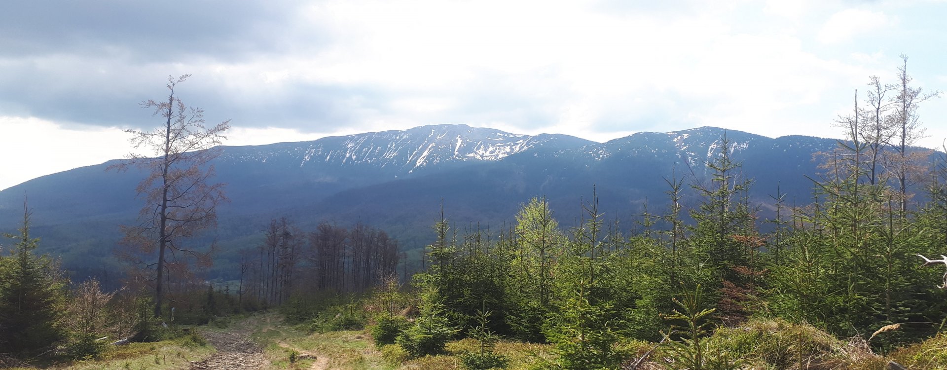
We start the trip in the Zawoja-Czatoża district. There is a place to park several cars at the no-traffic sign right at the entrance to the trail. Initially, we walk along a wide, paved road. After a while, a crossroads appears and at this point we follow the yellow and black signs. Then the two trails split - we continue following the black signs towards the Jałowiecka Pass. The route is initially gentle, then steeper. Due to forestry works, there are often large amounts of mud on it, which may pose some difficulties. After about 1.5 hours, we reach the Northern Jałowiecka Pass, called Tabakowy Siodło, through a steep climb, from where we can admire the views of the Babia Góra massif. Then we pass through the Southern Jałowiecka Pass, also known as Jałowcowy Siodło, where there is a large junction of tourist trails. Here we take the border trail, combining four trail colors (Polish red and green and Slovak yellow and blue), leading towards the peak of Mędrałowa. After about 1 hour we reach another crossroads, where we turn left following the red and blue signs leading to the highest point of our hike. It takes us about 5 minutes to get there. At the top there is a beautiful Hala Mędralowa, from where there is a nice view of the Beskid Mały and Jałowiec. There is also a well-kept hut there. In a few minutes we return to our trail junction and continue following the green signs towards Hala Kamińskiego, which we reach in 20 minutes. Hala Kamińskiego, located on the top of Kolisty Groń, is a beautiful viewpoint of the Mędrałowa Group, the peaks of the Silesian and Mały Beskids, as well as the Pewelskie Range. At Hala Kamińskiego we turn onto the black trail, which will lead us to the starting point of our trip, i.e. Zawoja Czatoża. Babia Góra is particularly beautiful on this section. It will take us about 45 minutes to get to the parking lot.
Our rooms
In Pokoje Gościnne Mosorny Groń, we offer 26 beds in 9 comfortable rooms that are diverse in terms of standard and arrangement.